Magnesia on the Maeander is an ancient city in western Turkey that was founded by Greek colonists almost three milennia ago. It grew to be a prosperous town with all the architectural trappings of Hellenistic civilization, and later, Roman Imperial grandeur. Today the site of its main temple sanctuary is crossed by a highway, but few tourists stop to visit the ruins nestled among fig orchards and small farms.
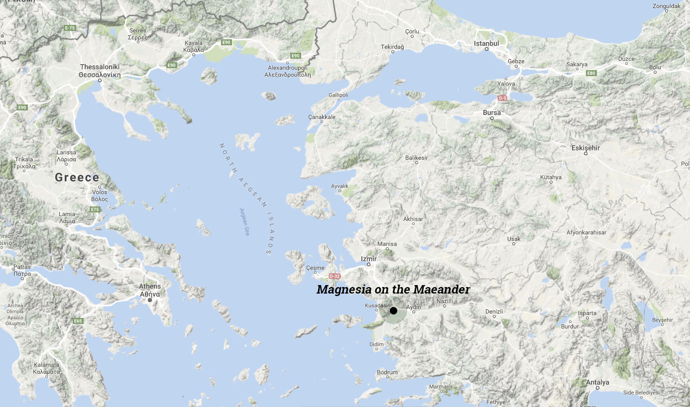
Location of Magnesia on the Maeander in western Turkey.
The Archaic Period (800 BC – 479 BC)
The city of Magnesia was originally located not at its present site, but approximately three miles away near the Maeander River. According to Diodorus Siculus (14.36), Magnesia’s original site was 120 stades (15km) from Ephesus, a distance which corresponds with the confluence of the Maeander and one of its tributaries, the Lethaios. In archaic times this location would have been close to the gulf of Miletus, and on the Maeander’s alluvium-rich northern bank [1]. Bingöl (2007, p.25) argues that the old city of Magnesia had been linked with the sanctuary of Artemis Leukophrene via a sacred path long before the famous temple by Hermogenes was built, in which case the original city would have been connected to the present site through topographical memory.
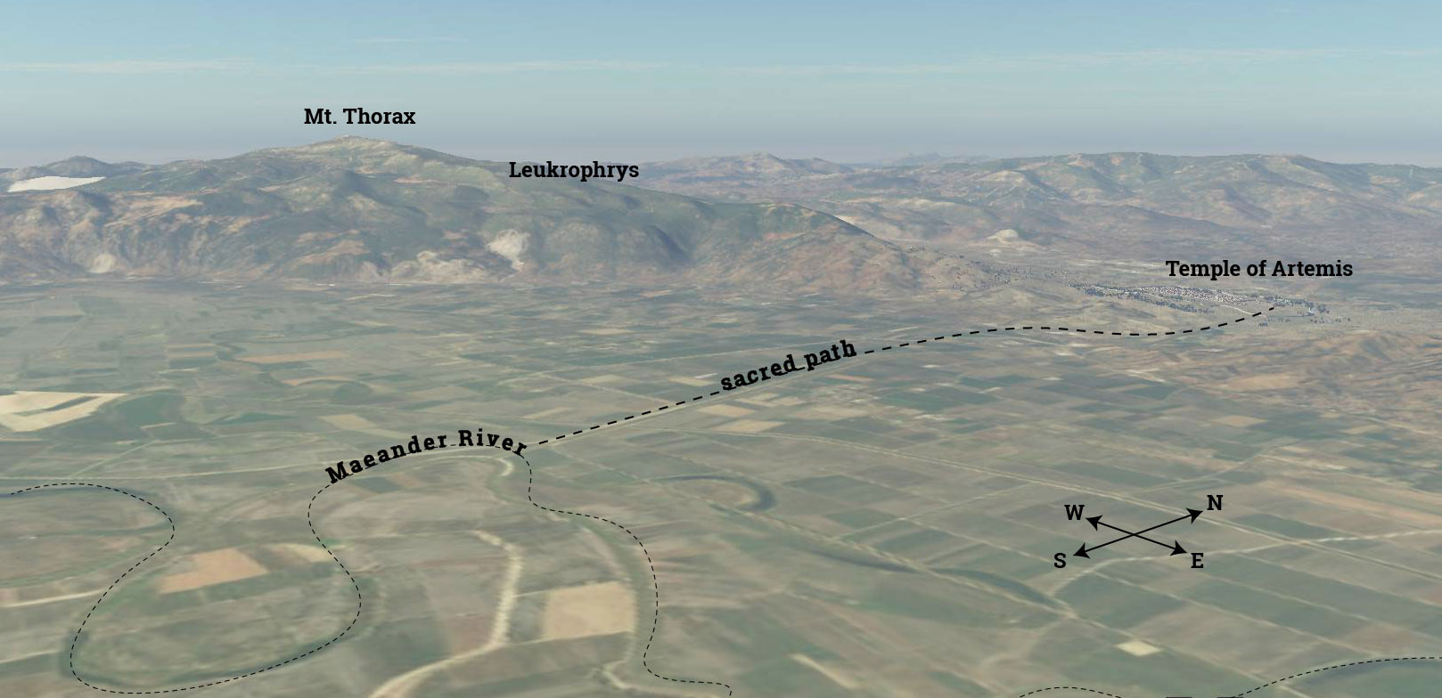
Possible original location of Magnesia near the Maeander River.
The archaic temple of Artemis was, according to Xenophon, near “a lake of more than a stadium in length, with a sandy bottom and an unfailing supply of drinkable, warm water” (Xen. Hell. 3.2.19). Artemis was a goddess often associated with marshy places (Scully, 1979) [2]. At Magnesia she may be an incarnation of the pre-Hellenic mother goddess (Cybele/Dindymene) to whom Themistocles built a temple and dedicated his daughter as priestess when he was ruler of Magnesia in the mid-5th century BC (Plut.Them.30.3). The lake would probably have been located in the marshy area of the plain near where the north-west corner of the city wall would later run. It may have been fed by a thermal spring that still exists in the village of Yeniköy (Bingöl, 2007, p.24). High ground water continues to flood the site seasonally. A settlement, perhaps called Leukophrys, may have occupied the higher ground towards the foothills, bordered in the west by the Lethaios. The archaic temple was hexastyle in plan, and made of local limestone. Column drums of the Ionic order, with Ephesus-type bases, were found in the foundations of the Hellenistic temple, and Humann suggested that wall remains below the eastern colonnade of the Hellenistic temple formed the foundation of the Archaic one (Humann 1904, pp.46-49). This would indicate that the two had the same orientation towards Thorax.
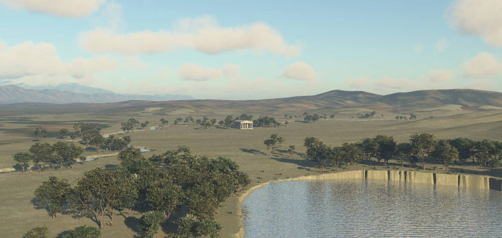
Rendering of the Archaic temple of Artemis in proximity to Lethaios river and a spring-fed thermal lake.
According to the founding myth of the city (Kern 1900, no.17) the Magnesians, who had settled in Crete after leaving their original homeland in Thessaly, saw white crows flying overhead [3]. Thinking this was a sign that they should return to their native land, they consulted the oracle at Delphi. The oracle told them that instead they were to settle in a different country, and that they would be led there by a man called Leukippos (“white horse”). Leukippos led them to a place called Mandrolytia, where the king’s daughter, Leukophryene, fell in love with him and betrayed her father’s city by opening the gates to Leukippos, thus allowing him to establish the archaic city of Magnesia on the Maeander. The recurrence of the term “white” -- in the color of the crows, the names of the hero and heroine of the founding myth, the name of the shrine of Artemis -- has been linked by Bingöl to the presence of silvery-white colored magnesium stone in the mountains near the city, although the name “magnesium” refers to the region in Thessaly, and was not associated with the metal until the eighteenth century. In antiquity the “stone of Magnesia” mentioned by Euripides and Plato refers either to magnetic iron-stone or to silver [4]. These references can be more confidently traced to Magnesia in Caria [5]. If the “stone of Magnesia” was originally silver this would be borne out by the presence of modern silver mines in Mt. Thorax, which is called Gümüşdağ (silver mountain) in Turkish, while the Lethaios River is known as Gümüşçay (silver stream), and a nearby village is called Gümüşköy (silver village). In any case, Mt.Thorax and the sanctuary of Artemis, both seem to have been tied together in associations of whiteness and luminosity since the earliest settlements in the region.
The Classical Period (480 BC – 322 BC)
As the mouth of the river gradually silted up the Maeander valley, the ancient maritime cities on the gulf of Miletus were abandoned. Around the same period, the need for defenses became pressing, and the original Magnesia did not possess any defensive walls or topography. Diodorus (16.36) recounts that Thibron, a Spartan commander who had come to Magnesia via Ephesus to fight against the Persians in 400 BC, was concerned that the unfortified location of the city would lead the Persians to recapture it after his departure. He therefore temporarily moved the population to the foothills of Thorax. Bingöl (2007, p.30) identifies this location with the remains of an ancient settlement called “Büyük Manastır” (large monastery) by local inhabitants and “Leukophrys” by scholars [6].

Plan of Magnesia and environs. Road and site of Leukophrys/Hylai after Philippson (1936).
It was below this mountain fortress that the Magnesians founded their new city sometime after the Peace of Antialkidas in 386 BC (Bingöl 2007, 31) [7]. At this time, around 60 years after Hippodamus planned the new city of Piraeus, it is likely that a grid would have been laid out and the basic dimensions of its city blocks devised. The agora, theater, and stadium must have existed at the founding of the city, but their form in this period is unknown, obscured by later renovations. Most probably at this point, the agora was simply an open space carved out from the city grid and based on the dimensions of the insulae, perhaps flanked by freestanding stoas or buildings.

Two renderings of Magnesia in the Classical period.
The Hellenistic Period (323 BC – 145 BC)
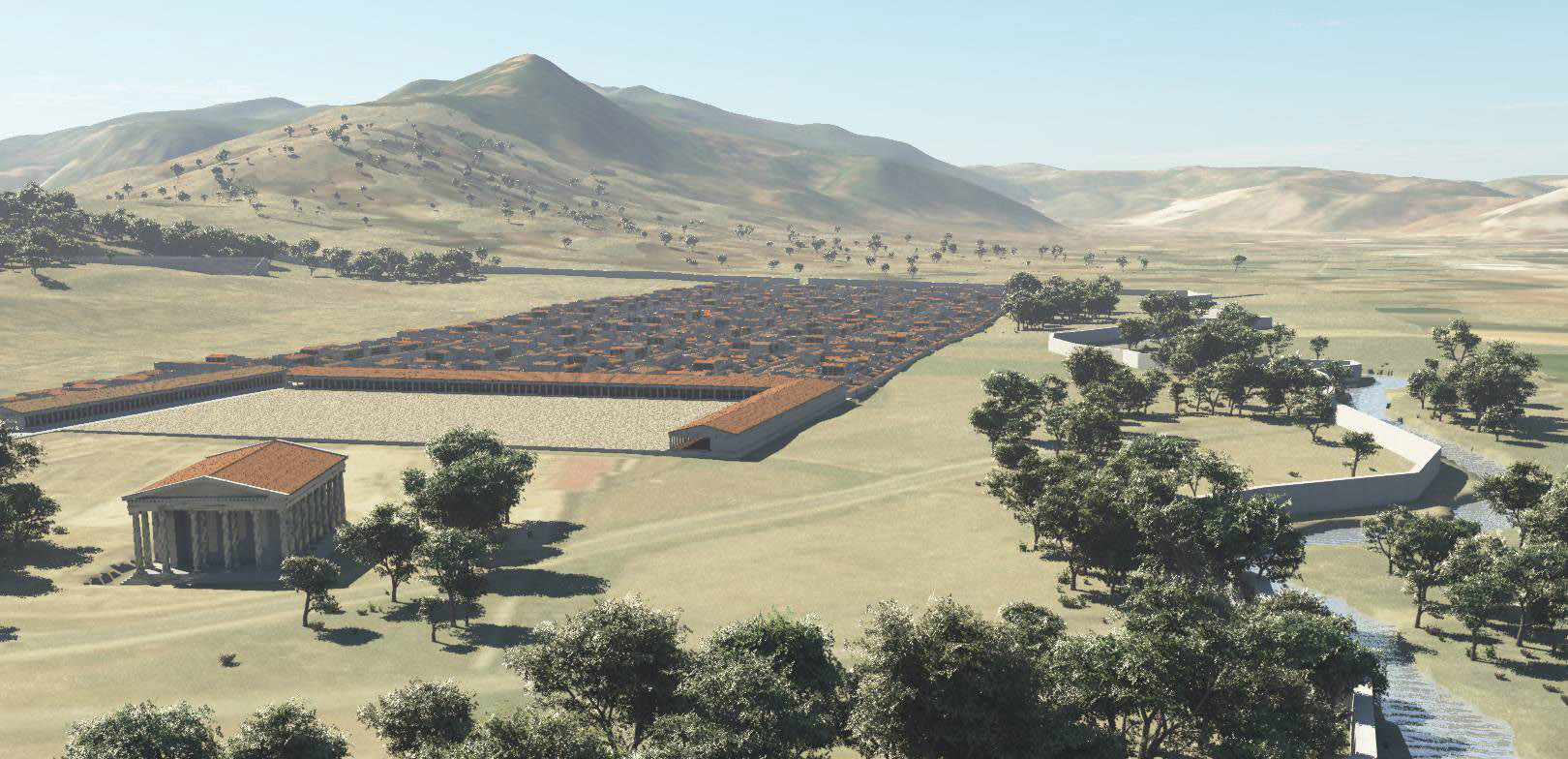
In the second half of the third century BC Magnesia saw a period of increased architectural development that left its mark on the major monuments of the city. Following an epiphany of Artemis in 220 BC that gave rise to the institution of the Leukophryena games (Kern 1900, No.16) [8], the city invested in renovating its public buildings. It is to this phase that the construction of the pseudodipteral temple of Artemis, attributed to Hermogenes, belongs. In addition to the temple, the stoas surrounding the sanctuary, the altar of Artemis, the stoas of the Agora, and the temple of Zeus Sosipolis (another possible work of Hermogenes), all belong to this period (Humann 1904, p.22).

Rendering of Magnesia in the Hellenistic period.
The Artemision sanctuary (3rd -- 2nd c. BC), Magnesia’s most extensively excavated area, is visible from the highway [9]. The orientation of the temple of Artemis was clearly important enough to be preserved and even emphasized by its enclosure. Ritually, the Magnesians remained oriented towards Thorax even as their city plan took a more pragmatic shape from the cardinal directions.
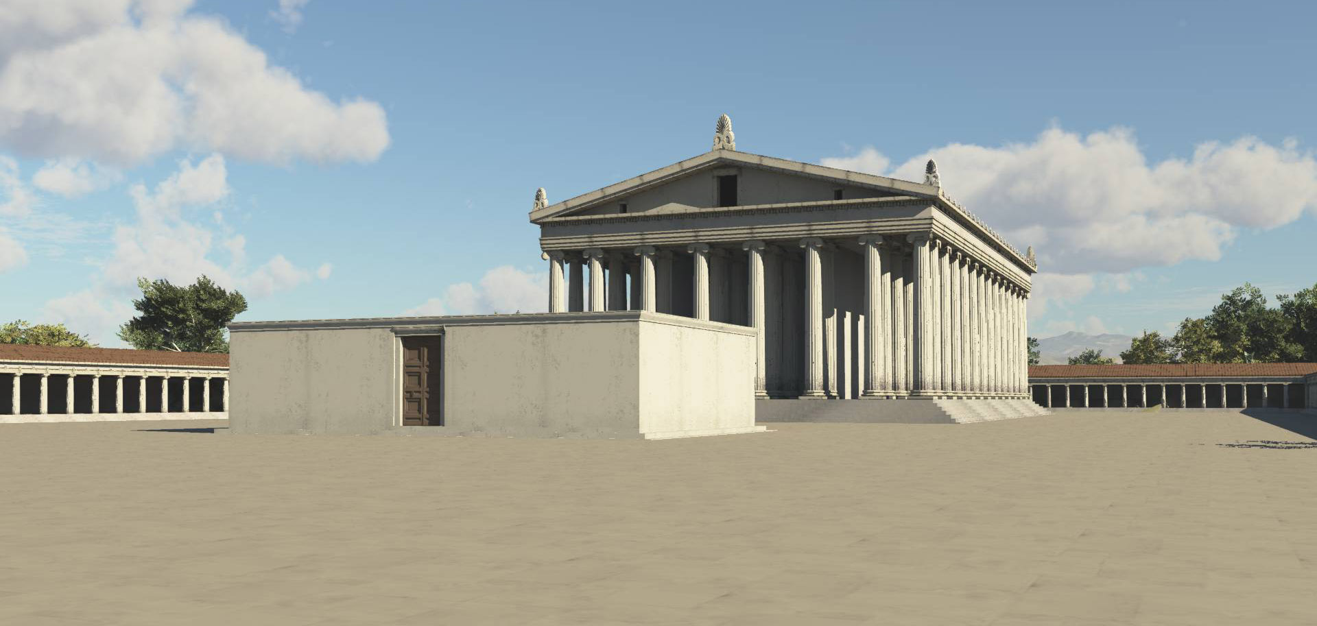
Rendering of the Artemision stoa, temple, and altar in the Hellenistic period.
Agora at this time took on the form of the ‘Ionian type’ clearly exemplified by the agoras at Miletus and Priene. This comprised a U-shaped stoa bordered at the south end by the main road of the city, with another stoa with shops behind closing off the U-shape to form a complete rectangle. In the Hellenistic period, the road was probably left open to traffic, gates only being interposed in the Roman period (Humann 1904, pp.109-110). The agora, although partially excavated by Humann in the late nineteenth century, is now mostly underground again, barring recent excavation work on the east stoa that has resulted in the discovery of a cryptoporticus. Within the agora stood the Hellenistic temple of Zeus Sosipolis, conjectured also to be the work of Hermogenes, since it typifies the eustyle described by Vitruvius (3.3.6). If the chronology given in a 2nd c AD inscription recording the foundation of the cult of Dionysos can be substantiated, then a temple of Dionysos was also built around this time. A temple of Serapis is also presumed to date to the Hellenistic period based on its early 2nd-century dedicatory inscription (Kern, 1900, no.99). The round temple of Athena on the hill above the theater was also added in the Hellenistic period, as was a temple dedicated to the Dioskouroi (Humann, 1904, p.27).
The Roman Period
Several large public buildings were added or restored during the Roman period. In the 1st century AD, the propylon between the agora and Artemision was built, along with the pavers of the “assembly area” immediately in front of the propylon.
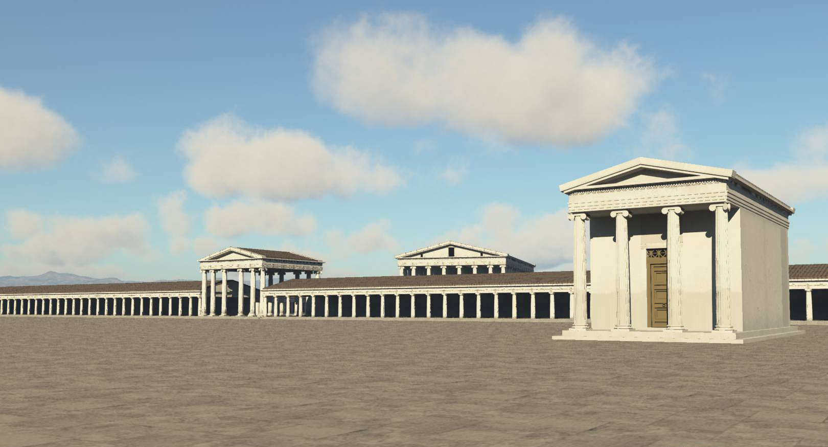
View of the Agora in the Roman period showing the temple of Zeus Sosipolis, and the propylon gate leading the the Artemision enclosure.
Adjacent to the agora a market basilica dating from the 2nd century AD has also been recently excavated and documented. South of the Artemision, a late Roman house with a hypocaust system has been uncovered, although in the same vicinity a Roman odeion, recorded by Humann, has been completely obliterated. A small, unfinished theater of the 1st century AD, unknown to early excavators, was uncovered by the Turkish team in the foothills to the south of the Agora. The unusual layout of this building, in which the seats for the audience had to be reached via the orchestra, is conjectured to have been intended for religious use (Bingöl, 2007, pp.157-158). Construction work on the small theater was probably discontinued due to a landslide.
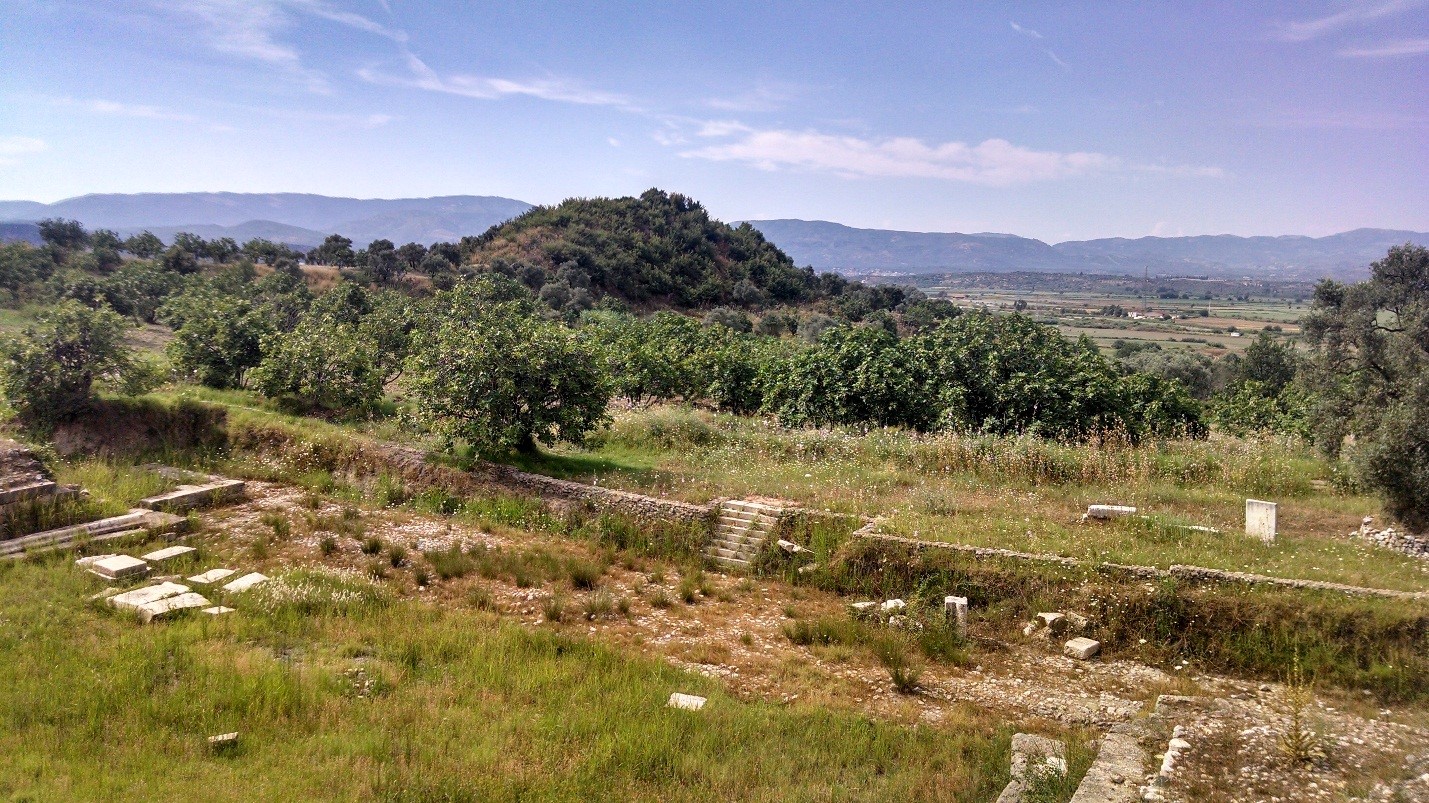
Magnesia's "tumulus" hill, seen from the orchestra of the small theater
Further west along the main route of the city lies the Roman gymnasium with its associated baths and palaestra. The apodyterion of the gymnasium is one of the best-preserved buildings in Magnesia, although it has not been fully excavated. A second gymnasium/bath complex, also from the Roman period, lies in the eastern part of the city next to the Lethaios River. The structure is aligned to the south-west, like the Artemision, in contrast to the rest of the city grid, which is oriented to the cardinal directions [10].
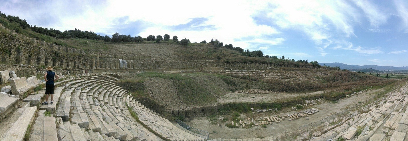
Magnesia's stadium in 2014
One of the most impressive buildings of Magnesia, the stadium, was covered by hillside in Humann’s time. Recent excavations have removed much of the earth on the east side of the stadium, revealing a large structure containing numerous inscriptions. The stadium was remodeled in white marble during Roman times, and had an imposing arcaded sphendone and starting block. Another building from the Roman era is a small unexcavated temple that stood on a high podium on the northern side of the Lethaios. The podium contains a vaulted substructure 2.5m high, according to the drawing published by Humann (1904, p.31).
The layout of the city remained essentially the same from the city’s founding to the Roman Imperial age, but the Roman enlargement of the gymnasia and addition of baths, market basilica, and odeion, as well as the marble renovation of the stadium, suggest a prosperous population eager to be entertained and to impress visitors from other cities. By contrast, almost all of the city’s known religious architecture, including the temples of Artemis, Zeus, Athena, Dionysos, Serapis, and the Dioskouroi, appear to have been built in the Hellenistic period, or at any rate retained their Greek aspect. Perhaps this indicates that Magnesia’s religious culture remained Greek and saw little need to change, even as its citizens acquired Roman recreational habits. This pattern seems to have held true for Magnesia’s civic architecture and identity as well. Unlike the city center at Aphrodisias, which became increasingly monumentalized under Roman rule (Ratté, 2002), changes to the agora and Artemision at Magnesia were relatively small in scale: the addition of the propylon connecting the two spaces, the addition of gateways to the agora entrance, a library and latrine behind the stoas of the precinct of Artemis. These rather small changes had great impact, however – they served to articulate the transitions between public areas: between street and square and sanctuary, in the manner of Roman armatures elsewhere in the empire (MacDonald, 1988). Thus while Magnesia retained its Hellenistic orthogonal plan and civic architecture, it did acquire some aspects of the “passage architecture” that gave Roman cities their characteristic spatial choreography.
It was within this context that the rituals linking the city of Magnesia to the cave of Apollo were defined. 3D modeling allows the full impact of small-scale changes to be assessed. A relatively minor intervention, such as the propylon, would barely register on a two-dimensional plan, where its footprint looks much the same as the adjacent stoa. However, realized in three dimensions, the impact of the propylon marking a monumental transition truly comes to the fore. The effect of Hellenistic planning also becomes evident. The 3D model demonstrates how a visual sequencing was achieved by the strategic placement of the Zeus temple in the Agora. As a visitor arrived at the agora’s west entrance, the spectacular temple of Artemis was fully concealed behind the much smaller temple of Zeus. It was only on approach to the temple on axis that the space unfolded fully [11]. The spatially-oriented, visual approach afforded by the holistic urban model allows these instances of design thinking to become perceptible and linked with the broader context of the city’s development.
Archaeology at Magnesia
Interest in finding and documenting Magnesia was largely inspired by the fame of the Artemis temple and precinct. British geographer William John Hamilton was the first to correctly identify the site around 1800 [12]. Fellow Englishman and antiquarian William Martin Leake published an account of the determination of Magnesia’s location, describing how it was to be sought on the road between Ephesus and Tralles beneath a mountain called Thorax, as described by Strabo (XIV.1.39; Leake 1824, p.243). After Hamilton, the French were the next Europeans to study Magnesia. Drawings were made in 1817 – 1821 by Jean-Nicolas Huyot, the site was visited in 1838 by Desiré-Raoul Rochette, and eventually an excavation of the temple was attempted in 1842 – 1843 by a team led by Charles Texier along with the architect Jean Jacques Clerget. The drawings by Clerget, as well as the other early documentation which show the location of structures such as the theater, odeion, and city gates, which have since all but disappeared, remain largely unpublished and are held in the Bibliothèque National in Paris. Since 1985 excavations of the site have been ongoing and conducted by Ankara University under the directorship of Orhan Bingöl [13]. The state of Magnesia’s excavated urban fabric is partial, although much remains to be explored 4-5m below the surface of the farmland. The ruins are listed and described in detail by Bingöl (2007).

The Artemision at Magnesia in 2010 (view towards south)
Notes
[1] P. Thonemann’s 2011 geographical history of the Maeander valley explains the geological conditions which led people to settle on the north bank of the Maeander from antiquity to the present day. The south bank of the Maeander does not drain directly into the valley and therefore lacks the rich alluvium deposits of the northern foothills. It is also prone to heavy flooding (Thonemann 2011, 10-14).↑
[2] The Artemision at Ephesus also lies on swampy ground.↑
[3] The account of Magnesia's founding is one of the most complete such inscriptions that survive. An English translation is available in Bingöl 2007, 16. ↑
[4] “Looking at men’s opinions, he attracts and then releases their belief like Magnesian stone”. (Euripedes, Oeneus, 567); “[A] divine power, which moves you like that stone which Euripedes named a magnet, but most people call “Heraclea stone”.↑
[5] This mainly rests on the “Heraclea stone” being linked with the presence of places called Heraclea near Magnesia. It may simply mean “Hercules’ stone”, i.e. magnet stone rather than silver.↑
[6] Following Alfred Phillipson (1936), Bingöl calls this place Leukophrys after the passage in Xenophon (3.2.19), though the toponym associated with Xenophon’s description, unless it is meant to cover a very general area including the foothills of Thorax, seems rather to describe the location of the Artemision. Philippson’s map delineates the borders of the site he calls Leukophrys. I could find no other map locating the site, though Humann (1904, Blatt I) does show a “watchtower” in this location. Bingöl’s mentions of the “Büyük Manastır” (2007, p. 30) certainly correspond with this site, though he does not indicate its precise whereabouts. According to H. Lohmann (2006), Philippson “identified a fortified ancient settlement with orthogonal street layout” at this location, although I have not been able to verify this.↑
[7] See also Strabo (XIV.1.58) ↑
[8] After the epiphany the Magnesians consulted the oracle of Apollo at Delphi, who instructed them to institute an agon (athletic competition). However, it was fourteen years before the plan was realized. The responses from the cities of Greece who responded to Magnesia’s invitation to the games were displayed on the walls of the agora. See Bingöl (2007, pp.65-67); and Thonemann (2007). ↑
[9] The Artemision was fortified by thick stone masonry walls in the Byzantine period, by which time the population of the city had shrunk dramatically. These walls, which make use of spolia from the earlier Hellenistic city walls, are still standing in large stretches and are a prominent part of the ruins today. Though they hinder the excavation of earlier material, they cannot be removed without damaging the structures. ↑
[10] Bingöl (2007, 168) considers this simply a response to the course of the Lethaios, though the state of this area in the original plan of the city, perhaps influenced by a prior settlement in the area of the sancturary of Artemis, should also be considered (see Ch.5.1 below). ↑
[11] The location of the entrance to the Artemision in the Hellenistic period is not clear, although it presumably was at the center of the agora’s east stoa where the Roman propylon was later interposed. ↑
[12] This attribution is upheld by Leake (1924), Rennel (1831), and Rayet (1845). ↑
[13] Professor Bingöl and his team have generously shared their drawings and excavation reports as part of a collaboration between Ankara University and UCLA’s Experiential Technologies Center. ↑